


Voting District 0700001, Suffolk County, New York
About
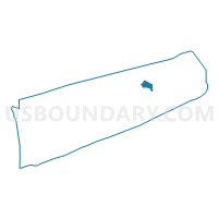
Outline

Summary
| Unique Area Identifier | 637153 |
| Name | Voting District 0700001 |
| County | Suffolk County |
| State | New York |
| Area (square miles) | 10.86 |
| Land Area (square miles) | 3.30 |
| Water Area (square miles) | 7.56 |
| % of Land Area | 30.36 |
| % of Water Area | 69.64 |
| Latitude of the Internal Point | 41.08055530 |
| Longtitude of the Internal Point | -72.29199750 |
Maps


Graphs
Select a template below for downloading or customizing gragh for Voting District 0700001, Suffolk County, New York


Neighbors
Neighoring Voting District (by Name) Neighboring Voting District on the Map
- Voting District 0300012, Suffolk County, NY
- Voting District 0700002, Suffolk County, NY
- Voting District 0700003, Suffolk County, NY
- Voting District 1000002, Suffolk County, NY
- Voting District 1000003, Suffolk County, NY
- Voting District 1000019, Suffolk County, NY
Top 10 Neighboring County Subdivision (by Population) Neighboring County Subdivision on the Map
- Southold town, Suffolk County, NY (21,968)
- East Hampton town, Suffolk County, NY (21,457)
- Shelter Island town, Suffolk County, NY (2,392)
Top 10 Neighboring Place (by Population) Neighboring Place on the Map
- Shelter Island CDP, NY (1,333)
- Shelter Island Heights CDP, NY (1,048)
- Dering Harbor village, NY (11)
Top 10 Neighboring Unified School District (by Population) Neighboring Unified School District on the Map
- School District Not Defined, NY (13,644)
- East Hampton Union Free School District, NY (8,540)
- Greenport Union Free School District, NY (4,484)
- Shelter Island Union Free School District, NY (2,392)
- Oysterponds Union Free School District, NY (1,605)
Top 10 Neighboring State Legislative District Lower Chamber (by Population) Neighboring State Legislative District Lower Chamber on the Map
Top 10 Neighboring State Legislative District Upper Chamber (by Population) Neighboring State Legislative District Upper Chamber on the Map
Top 10 Neighboring 111th Congressional District (by Population) Neighboring 111th Congressional District on the Map
Top 10 Neighboring Census Tract (by Population) Neighboring Census Tract on the Map
- Census Tract 2009.02, Suffolk County, NY (6,410)
- Census Tract 1702.02, Suffolk County, NY (4,029)
- Census Tract 1803, Suffolk County, NY (2,392)
- Census Tract 1701.01, Suffolk County, NY (2,197)
- Census Tract 9901, Suffolk County, NY (0)
Top 10 Neighboring 5-Digit ZIP Code Tabulation Area (by Population) Neighboring 5-Digit ZIP Code Tabulation Area on the Map
- 11937, NY (15,398)
- 11944, NY (4,299)
- 11964, NY (1,858)
- 11939, NY (926)
- 11957, NY (743)
- 11965, NY (534)